Our Guide will meet you at the airport and then you will drive about 2,5 hours from the airport to your hotel in Sembalun.
Accommodation : (or similar)

- Reference Hotel Pictures


After early morning breakfast, we will start trekking to Plawangan Sembalun Crater Rim ( as the base camp). This day will be treated with views of many savanna.
Then we will break for lunch at Pos 3 after walking about 3.5 hours. After lunch, then continuing the trek to Plawangan Sembalun about 3-4 hours climb up. Overnight at tent.
Accommodation : RinjaniTent in Camping site
Meal : Breakfast; Lunch (Picnic); Supper (Camp Meal)
Trekking Distance : 8.5 kilometers
Trekking Time : 7-8 hours
Altitude Gains & Losses : +1439 meters
Highest Altitude : 2639 meters

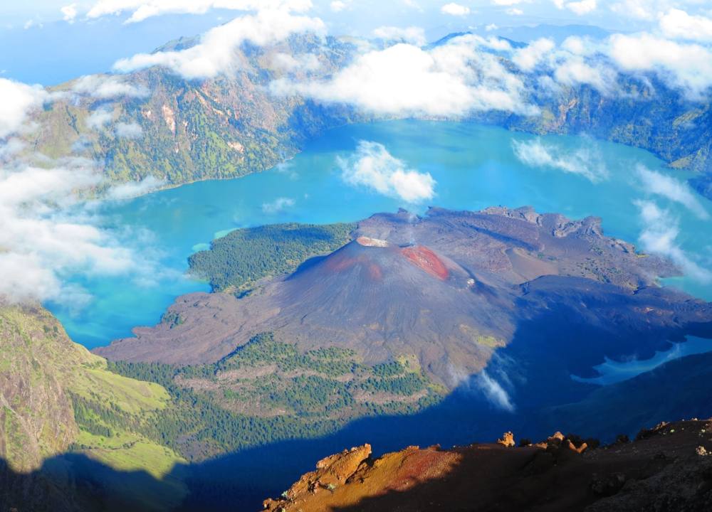
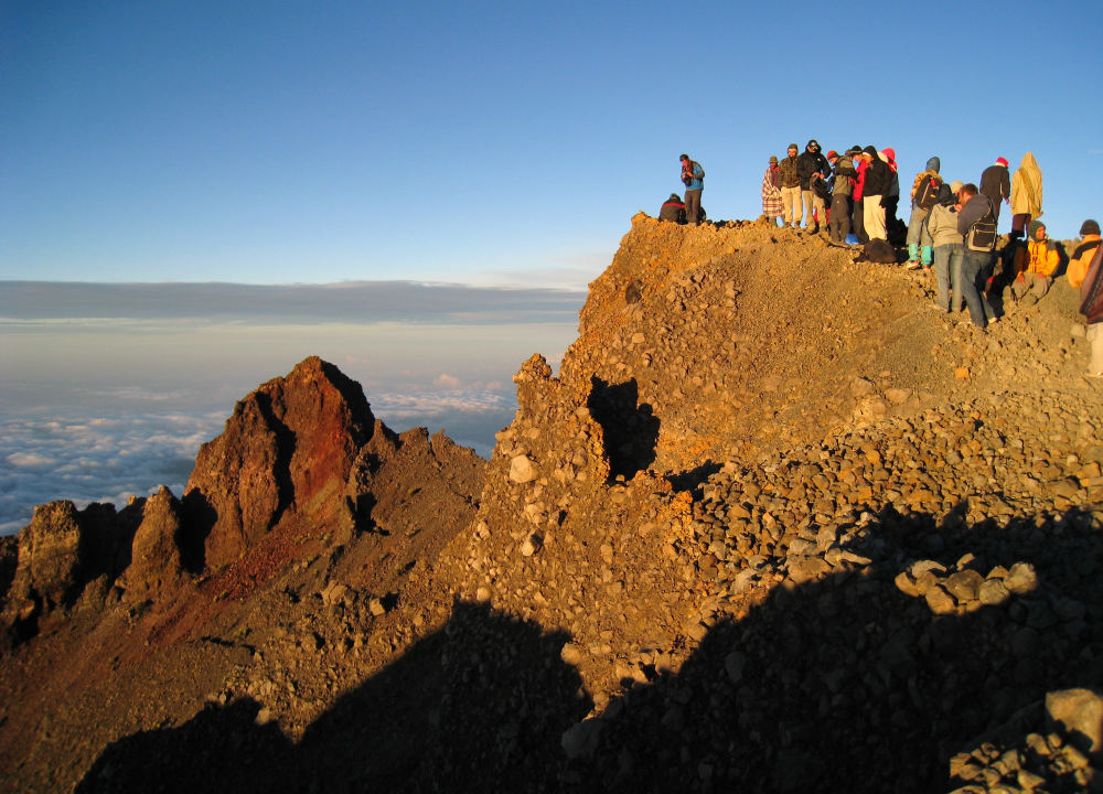
We will begin the summit at 02.00 am, a field trip to the summit and weight quite tiring, deserts, craters, and canyons that seem unfounded, will force the adrenaline walking up during the 4 hours climb, so we recommend wearing an spectacles avoid splashing the sand and thick sweater, if for beginners to the top have to walk slowly, after our reached the summit of Mount Rinjani 3.726m you will be able to see the incredible scenery, as you can see all parts of the island of Lombok. You can even see good Mount Tambora and Mount Agung, and also some small island called Gili around the island of Lombok, enjoy proud feelings of satisfaction and the amazing sunrise views across to Mount Agung on Bali and Mount Tambora on Sumbawa. Then descent down to Plawangan Sembalun and take your breakfast before we go to Segara Anak Lake. Explore Segara Anak Lake. Overnight at tent.
Accommodation : SembalunTent in Camping site
Meal : Breakfast; Lunch (Picnic); Supper (Camp Meal)
Trekking Distance : 6.2 kilometers
Trekking Time : 6-7 hours
Altitude Gains & Losses : +1087/-1087 meters
Highest Altitude : 3726 meters


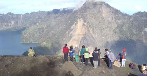
After breakfast, at 07.30. From Segara Anak Lake, we will go to Plawangan Senaru Crater Rim which is another spot that we will passing by on our way back down towards Senaru Village.
We’ll hike to the crater of Plawangan Senaru (2641m)and will takes 2 hours hiking then trekking down to Senaru Village and drive to Senggigi Beach Area.
Accommodation : (or similar)
Meal : Breakfast; Lunch (Picnic)
Trekking Distance : 15 kilometers
Trekking Time : more than 8 hours
Altitude Gains & Losses : -1400 meters
Highest Altitude : 2000 meters

- Reference Hotel Pictures


After breakfast we drive to Teluk Nara/Nipah and by Chartered boat to Gili island for Snorkeling and other water activities. After hopping island tour end we will back to the hotel at the afternoon.
Accommodation : (or similar)
Meal : Breakfast


- Reference Hotel Pictures
Drive from hotel to Lombok International Airport. Tour end
Accommodation : Own arrangement
Meal : Breakfast
Route Type Trekking
Route CodeINLORIADV
Follow our subscription account to stay informed about the latest Pama information and the most unique outdoor travel routes around the world.

For online consultation, route consultation, event customization, and business cooperation, please add Xiaoma WeChat.